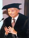
Resume of Prof. Dr. J.L. (John) van Genderen
Background

Born in Jutphaas (Utrecht), the Netherlands during the Second World War, Professor Van Genderen's family emigrated to Australia where he was brought up in tropical north Queensland. He received his Bachelor degree (with honours) in physical geography, with specialization in air photo interpretation from the University of Queensland in 1966, after which he came to ITC, where he received a Post Graduate Diploma in 1967 and his MSc in 1969. In 1972 he completed his PhD in Remote Sensing at the University of Sheffield, United Kingdom, where he was a Lecturer in Remote Sensing until 1976. From 1976 to 1986 he worked for various remote sensing companies based in U.K., Belgium and USA before returning to ITC full time in May 1986. He holds the chair in Operationalization of Remote Sensing Applications in the Earth Sciences.
Professor Van Genderen has carried out remote sensing application projects in some 100 developing countries over the past 30 years. Some of his main research interests, in terms of technology, have been in the areas of airborne sensors, image and data fusion, thermal infrared and SAR interferometry. In terms of applications, he has done much research into the detection, measurement, monitoring and prediction of underground coal fires as well as in the detection and mapping of minefields and landmines, for humanitarian demining, in addition to the more traditional applications in the area of natural hazards and coastal zone studies.
He has supervised numerous PhD, post-doctoral and visiting scholars at ITC and elsewhere. Professor Van Genderen has received many research grants and rewards over the years and is an Honorary Professor at Wuhan University, China, the National University of Mongolia in Ulaan Bataar, as well as at the Xi'an University of Science and Technology in China.
Activities in education
Supervision of MSc research projects.
Production of multi-media distance learning remote sensing packages.
Supervision of PhD researchers.
On-site training courses in remote sensing in developing countries.
Activities in research
Scientific advisor to various research programmes.
High resolution satellite data for minefield detection.
Multi-stage remote sensing for coal fire detection and monitoring.
Activities in project services
Professor Van Genderen has carried out consulting assignments and projects for many donor agencies in numerous developing countries.
